
Crossroads Canyon
State Park

About Crossroads Canyon
Crossroads Canyon State Park includes 4.5 miles of the Carson River, where cottonwood riparian forests, wetlands, and oxbow ponds contrast with surrounding sagebrush uplands. The river corridor forms a ribbon of green through the arid Great Basin desert and provides critical habitat for wildlife. We are currently seeking input from residents, visitors, outdoor recreation enthusiasts and community stakeholders to help form the park’s future! Public feedback will be an important part of developing a master plan that guides future improvements, public access, recreational opportunities and long-term resource management.
HELP SHAPE THE FUTURE OF CROSSROADS CANYON STATE PARK
With the park’s offical name established, Nevada State Parks is moving forward with planning efforts to determine how the property can best serve the public while protecting its natural and cultural resources.
The division is seeking input from residents, visitors, outdoor recreation enthusiasts and community stakeholders to help form the park’s future. Public feedback will be an important part of developing a master plan that guides future improvements, public access, recreational opportunities and long-term resource management.
You are encouraged to explore the park’s history and features by visiting this interactive map and guide. Fill out the survey at the end of the guide to share your ideas and help shape the park’s future. The survey is available Saturday, October 31, 2026 through Tuesday, December 15, 2026.
FACILITIES & AMENITIES
Fishing: Catch-and-release bank fishing techniques are used to catch walleye, white bass, the hybrid wiper, catfish, trout and other game fish. The Nevada Department of Wildlife maintains fishing regulations. See a Health Warning from the Department of Wildlife on consumption of fish.
Picnicking/Day Use: Areas beyond Fort Churchill Road are currently closed to public use during the planning and development phase.
Programs: Upcoming programs may include workshops to help build the master plan. Check back regularly and follow @nvstateparks on social media to stay informed.
Hours: The new state park is not yet open to public access. Fort Churchill Road, which passes through the park property, remains open to the public as a county road. Areas beyond Fort Churchill Road are currently closed to public use during the planning and development phase.
Prior to a full opening, Nevada State Parks will complete a master plan for the park and develop necessary amenities, which may include trailheads, trails, restrooms, and picnic areas.
FIELD NOTES
- Pets are welcome, but they must be kept on a leash of not more than six feet in length.
- Collection of firewood within the park is not allowed.
- Campfires are not allowed in this park
- Drive only on established roads. All vehicles and drivers must be licensed.
- Removing, disturbing or damaging any historic structure, artifact, rock, plant life, fossil or other feature is prohibited. State and federal laws protect this area and its resources.
- Hunting is not permitted in the park.
- The use of drones or any remote controlled aircraft is not allowed. Visit B4UFLY for more info.
- Visitors are responsible for knowing all park rules and regulations in effect. Detailed rules and regulations are posted at the park or may be viewed on the Park Rules page.
- Those with developmental and/or physical limitations are invited to enjoy all of the recreational activities of Nevada State Parks. If you would like to request additional support or accommodations, please call the Nevada State Parks division office. We continually seek ways to provide recreational opportunities for people of all abilities and welcome any suggestions you may have.
- View a list of frequently asked questions.
NATURAL RESOURCES/CLIMATE
Crossroads Canyon State Park is located along 4.5 miles of the Carson River just east of Dayton in Lyon County. Cottonwood riparian forests, wetlands, and oxbow ponds contrast with surrounding sagebrush uplands. The river corridor forms a ribbon of green through the arid Great Basin desert and provides critical habitat for wildlife. Wildlife found on the property can include mule deer, bobcat, waterfowl, mountain lion, migratory songbirds, raptors (birds of prey), reptiles, and bats. Fish species in this stretch of the river can include largemouth and smallmouth bass, as well as channel and bullhead catfish. Historic structures and cultural resources dating to the late 1800s and early 1900s are also present, and the site lies along two historic overland trails—the California Trail and the Pony Express Trail.
HISTORY OF CROSSROADS CANYON STATE PARK – Established in 2026
We are currently uncovering the history of Crossroads Canyon. If you have any first-hand knowledge of the area, we want to hear your story! Please reach out to stparks@parks.nv.gov.
push your boundaries
Explore More Nevada State Parks

Dayton
Overflowing with willows, sagebrush and cottonwoods, the park is a picturesque site for camping, picnicking and hiking. Its riches also include the remains of a 1860s silver mill, one of the first to process ore from the Comstock Lode.
- Quick Look
- Full Park Detail

Dayton
Dayton, Nevada- Amenities
- View Description
- Full Park Detail
Fort Churchill
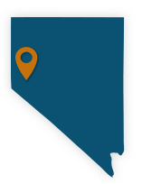
An Army post built in 1861, Fort Churchill helped guard the Pony Express route and acted as a base for hundreds of soldiers. Visitors today can walk designated trails to study the ruins and can camp, picnic and enjoy fishing and swimming in the Carson River.
- Quick Look
- Full Park Detail
Fort Churchill
Silver Springs, Nevada- Amenities
- View Description
- Full Park Detail
Lahontan
With 69 miles of shoreline, Lahontan Reservoir is a popular place to boat, fish, water-ski, horseback ride, camp, hike and enjoy the outdoors year-round. Canoeing from Fort Churchill to the lake makes for a great day trip when conditions allow.
- Quick Look
- Full Park Detail

Lahontan
Silver Springs, Nevada- Amenities
- View Description
- Full Park Detail